Mont-Saint-Michel Tides and Guided Bay Walks: Times, Safety, Prices
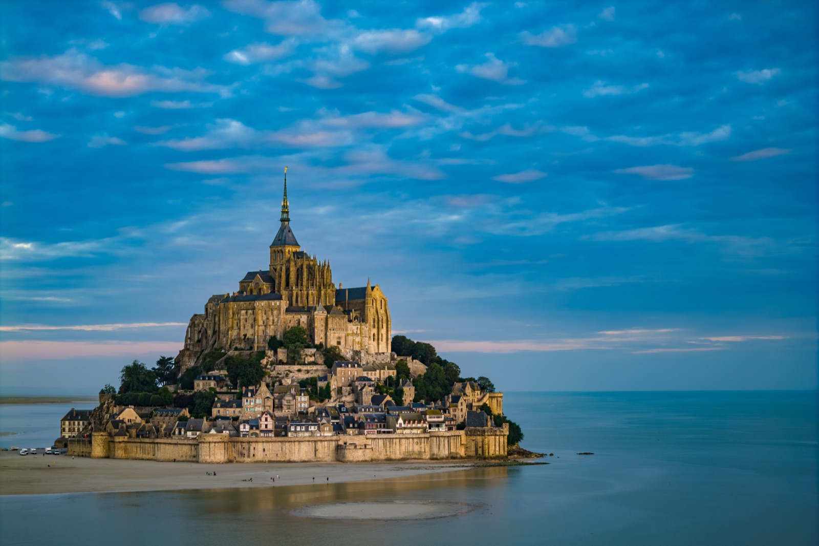
The bay around Mont-Saint-Michel has the highest tides in continental Europe. The difference between low and high tide reaches up to 15 metres, and during high tides the sea withdraws 15 km from the coast and comes back very quickly. On most days the water never reaches the rock at all; at the biggest tides it surrounds it, and the Mont becomes an island for about an hour.
The other way to experience the tides is on foot, crossing the sands with a guide as pilgrims once did. That is not something to try alone: being a certified guide, a certificate issued by the Préfecture de la Manche, is a compulsory condition for leading tourists on crossings, and the dangers — the incoming tide, quicksand and river channels — are real. Guided walks range from a short quicksand demonstration beside the Mont to a full crossing from Genêts, at prices from €18 to €34.50 for an adult. This guide explains how to read the tides, where to watch them and how to choose a walk.
How the tides work here
Tides are driven by the moon and the sun. When they line up with the earth, the pull is strongest and you get spring tides; when they are at right angles, you get the weaker neap tides. In the bay of Mont-Saint-Michel the effect is accentuated.
- The strongest tides come 36 to 48 hours after full and new moons, and wind and air pressure can shift their timing and height.
- The most spectacular tides come around the spring and autumn equinoxes, in March and September.
- In neap tides the sea does not reach the Mont at all; in spring tides it does, but only 4 hours 30 after the tide starts to rise, roughly once a fortnight.
So the water you see lapping at the walls is not a twice-daily event. Most of the time the Mont stands in sand and mudflats, and the sea is a line on the horizon.
When does the Mont become an island?
Only at the biggest tides. Then the water covers the esplanade between the footbridge and the village entrance, and the Mont becomes an island for about an hour. The bridge-walkway was designed for this: it lets the sea flow freely around the rock, and since the works re-established the Mont’s maritime character in 2015, the island tides are back.
If you want to see it — or simply not be caught by it — the Mont’s public establishment gives two pieces of advice:
- Arrive 1 to 2 hours before high water to see the tidal bore and reach the Mont before the water surrounds it.
- Once you are cut off on the rock, allow 1 hour to 1 hour 30 before you can rejoin the footbridge.
The tourist office adds that, to watch the tide come in, you should be there two hours before the high-tide time.
Finding the tide times
Tide tables for the bay are based on Saint-Malo. The public establishment publishes a 2026 tide calendar for the Mont, and the tourist office posts the daily times and coefficients on its site. Look for the dates with the highest coefficients, then check the morning and evening high-water times. The tide can be influenced by wind and pressure, so treat any time as approximate and check again the day before.
Where to watch the high tide
You have several good viewpoints, from the rock itself and from the mainland:
- The West Terrace of the abbey. The widest view over the bay, if your visit coincides with the tide; you need an abbey ticket.
- The ramparts. The North Tower on the ramparts is a good place to watch the tidal bore, and the walls are free to walk.
- The bridge-walkway and the dam. From the mainland end you see the water close in around the rock.
- From a guided walk. Some walks are timed to meet the rising tide in the bay, with a guide to keep you safe (see below).
The tidal bore
On the rising tide of the biggest spring tides, a wave runs up the river channels ahead of the sea: the tidal bore, or mascaret. The tidal bore runs up the Sée, the Sélune and the Couesnon.
It is the subject of one of the bay’s best-known sayings. Legend says the tidal bore moves at the speed of a galloping horse; in reality it averages 6 km/h. That is still faster than you can comfortably walk on wet sand and through channels, which is exactly why the bay is no place to wander without a guide. The bore is most impressive where it enters the river mouths close to the Mont.
The Couesnon dam and its water releases
The dam you pass on the way to the Mont is part of the same system. The Couesnon dam was built from 2006 to 2009 to push sediment away from the rock and keep it an island.
- The dam’s regulated water releases start six hours after high water and last two to five hours.
- A release can raise the level of the Couesnon in the bay by about 40 cm, and the river bed widens.
These releases are one of the reasons guides plan crossings around the Couesnon carefully. The times of the day’s releases are shown on an illuminated sign at La Caserne, by the dam, and on the public establishment’s site.
Why you must never walk the bay alone
At low tide the bay looks like an easy, flat beach. It is not. It is extremely dangerous to venture alone into the bay, even close to the Mont. The tourist office says the dangers of the bay are very real, starting with the tide, and lists quicksand, river channels that are often unstable, the weather and the dam releases.
Quicksand is the danger people ask about most. Quicksand is not dangerous in itself, since you cannot drown in it, but it becomes a risk if the sand sets and you do not know how to get free — and the risk becomes serious when the tide is coming in. A guide knows where it forms and how to get out of it.
That is why the rule is simple: never venture out into the bay alone. Walk only with a certified guide. The islet of Tombelaine can be reached on foot only with a guide; it is a bird reserve.
The guided walks compared
Dozens of certified guides and several organisations run walks; the tourist office keeps a list. Two companies based at Genêts, Chemins de la Baie and Découverte de la Baie, publish their formats and prices, which give a fair picture of what is on offer:
| Walk | Start | Distance | Time | Adult price |
|---|---|---|---|---|
| English-language walk near the Mont (July and August) | Mont-Saint-Michel | 3 to 4 km | 2h30 | €18 |
| Short walk around the Mont | Mont-Saint-Michel | 3 km | About 2 hours | Check with operator |
| Mont to Tombelaine and back | Mont-Saint-Michel | About 6 to 7 km | 3 hours | €20 |
| Round-trip crossing | Genêts or Saint-Léonard | 13 to 15 km | 6 hours | €22 |
| One-way crossing, bus back | Genêts or Saint-Léonard | 7 to 8 km walking | 6h30 to 7h30 in all | €34.50 |
Prices are Chemins de la Baie’s current listed rates; children aged 3 to 14 pay less (€10 to €25.50), and under-3s go free. Every operator sets its own prices, and they change, so check before you book.
The classic crossing from Genêts
The traditional crossing starts on the Normandy shore and ends at the foot of the Mont. The main starting points are the Bec d’Andaine at Genêts and Mont-Saint-Michel itself, with Saint-Léonard and other points used depending on the tide. In neap tides crossings start from Saint-Léonard; at higher coefficients they start from the Bec d’Andaine.
There are two formats:
- Round trip on foot. Chemins de la Baie’s round-trip crossing covers 13 to 15 km in 6 hours, including a break of 45 minutes to an hour at the Mont. Découverte de la Baie’s round trip covers about 14 km in about 6 hours, with a 45-minute break on the Mont. It costs €22 for an adult and €13 for a child at Chemins de la Baie.
- One way, with a bus back. The one-way crossing with return by bus covers 7 to 8 km in 3h15–3h30, then free time at the Mont of 1h15 to 2h30 depending on the date. Including the walk, the break and the bus back, it takes 6h30 to 7h30, and costs €34.50 for an adult and €25.50 for a child aged 3 to 14.
On the way you cross sandbanks and wade through river channels, and the guide stops to explain the tides, the salt meadows and the quicksand. If you leave from the Bec d’Andaine, parking there is charged from 1 April to 31 October at €6 a day, with the first 2 hours free.
Shorter walks from the Mont itself
If you are visiting the Mont anyway, a shorter walk from its foot is the easiest way to get onto the sands.
- Quicksand and a tour of the Mount. Bay outings range from a simple discovery of quicksand (1h30) to a tour of the Mount (2h). The short walk around the Mont covers 3 km in about 2 hours (difficulty 1/3), suitable for children.
- Tombelaine. The guided walk from the Mont to Tombelaine and back covers about 6 to 7 km in 3 hours and costs €20 for an adult and €11 for a child. Tombelaine, the smaller rock to the north, was an English stronghold in the Hundred Years’ War and is now a bird reserve.
- In English. Chemins de la Baie runs an English-language guided walk near the Mont in July and August: 2h30 for 3 to 4 km, at €18 for adults and €10 for children aged 3 to 14.
The meeting points for walks from the Mont are just outside the walls, often at the Fanils entrance. Allow about 30 minutes from the car park to the Fanils entrance by shuttle, 45 minutes on busy days.
Big-tide and tidal-bore walks
On the biggest tides, guides run walks that end by watching the sea come in. The big-tide walk from the Mont covers 2 to 4 km and lasts 2h15 from May to September, 2h in April and October and 1h45 from November to March. It finishes with the tidal bore in the rivers and the sea closing around the Mont. These walks only run on spring-tide dates, so check the operators’ calendars before you plan the day around one.
The Brittany side of the bay
Most crossings to the Mont start on the Normandy shore, but the bay continues west into Brittany. The Maison de la Baie at Le Vivier-sur-Mer leads guided nature walks on the Brittany side of the bay, in groups of about 25. These are nature walks rather than crossings to the Mont: birds, salt meadows, quicksand and, on the longest, the Hermelles reef. Its walk to the Hermelles reef covers about 12 km. They suit visitors staying around Cancale or Saint-Malo who want a quieter side of the bay.
What to wear and bring
Walkers go barefoot or in neoprene shoes in good condition; no other shoes are permitted. The details depend on the season:
- April to October: outings are traditionally done barefoot, in shorts or leggings, with a windproof layer. Bring sun cream, a hat and sunglasses.
- November to March: neoprene booties that hold the ankle, leggings rather than jeans, and warm layers. In winter, neoprene booties can be borrowed if booked at least 48 hours ahead; boots are not suitable.
- Always: water, a snack, a rucksack for your shoes, and a small towel and an empty bottle to rinse your feet at the end.
Who should think twice
A crossing is a long walk on soft, uneven ground. The distance, unstable ground and river crossings mean you need to be in good physical condition; the guide can refuse a participant. Because of the risk of falls, crossings are not advised for pregnant women. Tell the operator about any health or mobility issue when you book. Families with small children are better served by the short walks from the Mont than by a full crossing.
Combining a walk with the abbey
The crossing and the abbey do not fit into the same few hours. A crossing’s break at the Mont leaves no time for the abbey, which needs half a day of its own. If you want both:
- Do a morning or afternoon walk from the Mont (quicksand, the tour of the Mount or Tombelaine) and visit the abbey in the other half of the day.
- Or do the full crossing one day and the abbey another, staying nearby.
Our guide to visiting the abbey covers tickets and timing, and the guide to getting to Mont-Saint-Michel covers parking and the shuttle.
Booking and timing
- Book ahead. Because group numbers are strictly limited, every outing must be booked.
- Arrive early. Walkers meet the guide 30 minutes before departure. For outings from the Mont, arrive at the car parks an hour before the start time; the shuttle wait can be long. A guide will not wait for latecomers, because the tide does not.
- Check the season. In winter there is no big crossing, only shorter outings such as the Bec d’Andaine to Tombelaine.
- Expect changes. Guides adjust routes to the tide, the weather and the dam releases on the day.
The tours page also lists guided bay walks and tours that include a crossing.
Frequently asked questions
Can you walk to Mont-Saint-Michel at low tide?
Only with a certified guide. Crossings leave from Genêts or Saint-Léonard; the round trip covers about 13 to 15 km in 6 hours. Walking the bay alone is extremely dangerous, even close to the Mont.
When is Mont-Saint-Michel an island?
Only at the biggest spring tides, when the water covers the esplanade at the village entrance for about an hour. The strongest tides come 36 to 48 hours after full and new moons, especially around the equinoxes.
How much does a guided bay walk cost?
At Chemins de la Baie, an adult pays €18 for the English-language walk, €20 for Tombelaine, €22 for the round-trip crossing and €34.50 for the crossing with a bus back. Children aged 3 to 14 pay less.
What should I wear for a bay crossing?
From April to October, go barefoot in shorts or leggings with a windproof layer. In winter, wear neoprene booties; no other shoes are permitted.
Is quicksand at Mont-Saint-Michel dangerous?
You cannot drown in quicksand itself, but it becomes a risk if you get stuck as the tide comes in. That is why walks are led by certified guides, who show you how to get free.
Can I do a bay crossing and visit the abbey on the same day?
Not on a full crossing: the break at the Mont is too short, and the abbey needs half a day. A shorter walk from the Mont in the morning or afternoon leaves time for the abbey.